
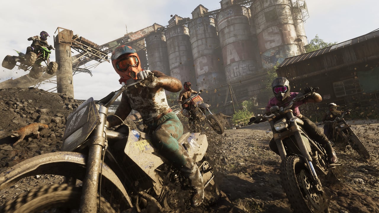
Quick answer: Mount Kalaga National Park is a wilderness destination near Leonida’s northern border, one of the clearest geographical statements Rockstar has made. The publisher associates the area with hunting, fishing and off-road trails. Its regional imagery depicts wooded hills, trails, hunters and a river, making it distinct from Grassrivers’ wetlands.
Exploring Mount Kalaga? Start with Rockstar’s free map through our official printable-map download guide, and use the locations and discoveries directory for player-specific activities. You can also follow parachute and aerial exploration tips. The printable map provides regional context; it is not a live mission or collectible map.
Confirmed places and features
| Place or feature | Evidence and significance |
|---|---|
| Northern border | Rockstar explicitly places the park near the state’s northern edge. |
| Hunting and fishing | Both appear in the publisher’s regional description; fishing is also developer-confirmed as an activity. |
| Off-road trails | Official material shows dirt bikes and an ATV in a rural setting. |
| Forest and river wildlife | The regional gallery depicts a big cat stalking deer near water. |
| Kayaking | Regional imagery depicts a kayak approaching a bridge. |
Can you hunt or fish anywhere in the park?
Rockstar’s description establishes the setting and its recreational identity, while Famitsu’s interview confirms fishing as part of GTA VI. That does not establish every fishing spot, species, bait, hunting reward or access rule. The animal-study collection mechanic is independently described by Nelson, so studying an animal is distinct from hunting it.
What makes Mount Kalaga different from Grassrivers?
Both are wildlife-oriented, but the confirmed terrain differs: Grassrivers is associated with low wetlands and mangroves, while Mount Kalaga is described as a northern wilderness with trails and forested terrain. That is why separate regional coverage can be useful even before exact routes are known.
What to verify when the game launches
Check actual trail entrances, fishing access, wildlife-study prompts, vehicle restrictions and the in-game map boundary. A screenshot of a canyon or river is evidence of a depicted scene, not permission to assume a complete navigable trail. No exact route, collectible coordinates or park entry requirement has been verified.
Related guides
Sources and review date
- Rockstar’s official Only in Leonida showcase
- Rockstar’s region-labeled screenshot library
- Corroborating review of Mount Kalaga descriptions and captions
- Famitsu interview: fishing
- IGN interview: animal studying
Reviewed November 12, 2026. Region names and publisher descriptions are distinguished from visual observations. No exact in-game routes, coordinates or gameplay access are claimed before release.